961 1 259 446 info@gistransport.com
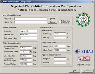
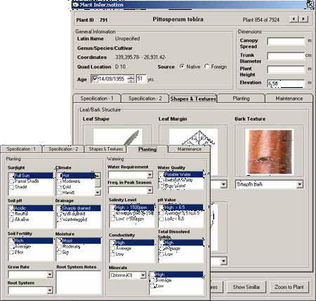
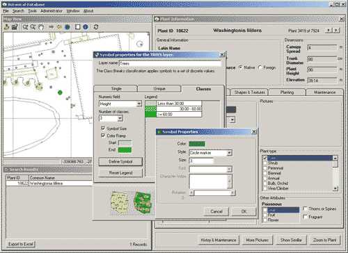
Our technical team delivers products ranging from simple tools to integrated applications. Irrespective of their complexities, our products are designed to manage rapidly and efficiently essential information.

Secrets of Success

800

Projects

16

Countries

200

Clients

GIS/Transport uses a team of professionals and experts in the engineering, social, and economic fields to design sustainable technical solutions. We have a track record of successful development of sophisticated spatial information databases, applications, and procedures for municipalities, worldwide.
Over the 21 years since its foundation and over the 16 years since its registration in Nigeria GIS/Transport has built a solid set of technical capabilities in all fields of digital mapping, remote sensing, field survey & GIS and has managed mega-projects of up to $20M and GIS service agencies of close to 100 staff.
Land Administration Projects
Mapping and Cartography Projects
Remote Sensing Projects
Satellite Imagery Projects
Software Engineering Projects
GIS Consulting Projects
Training Projects
Geodetic Engineering Projects
GIS/Transport has conducted a number of GIS/LIS development projects for Nigerian and international clients. Some of our most renowned projects are listed below. In addition, GIS/Transport members have individually been involved in a number of design, assessment, construction supervision, operation, and monitoring of various GIS, Mapping, Cartography, Master Planning and Engineering Projects.

Land Administration & Cadastre Projects

Location : Kaduna, Kaduna State, Nigeria
Detailed Narrative Description of Project:
The KADGIS Project is a response to the immediate need to provide Kaduna State with a modern and efficient land administration backed by automated systems and a fully trained staff that can produce secure land titles and increase Internally Generated Revenue (IGR).
Strategically KADGIS will gather, collate and digitise all geospatial data, store this information in a central database, and, through the KADGIS Service Centre, deliver products including maps, reports and analysis, supporting informed decision in all Kaduna State Ministries, Departments and Agencies (MDA).
The existing land, survey and town planning institutional structures will be streamlined with all policy and statutory functions brought together in one body (Statutory and Policy Unit), collocated with KADGIS, with coordinated and effective policy making, and simple statutory procedures geared to support KADGIS operations and the quick generation of products.
The new institutional structure will be supported by the passing of the KADGIS Law, leading to the development and publication of policy and regulations, together with revised fees, rates and rents.
KADGIS will support Good Governance, Transparency and improved Service Delivery across all Kaduna State MDAs, benefiting all stakeholder groups, professional associations, business and industry, and the general public, irrespective of rank or status.
Modern, responsive customer service will be a hallmark of KADGIS, with easy to understand application forms and guidelines, quick processing and the delivery of secure products backed by the electronic systems and databases. Customer interface will be provided by Service Points in Kaduna, Zaria and Kafanchan, with all services available via the website.
The automated systems and new fast procedures will also ensure that all legal and statutory requirements are met, delivering better results in a reliable manner, while retaining existing elements or processes that work, aligned these to the new systems. KADGIS will provide the Kaduna state government with an Enterprise GIS solution that can support the delivery of services and products to all Kaduna state MDAs, professional bodies, stakeholder associations and the general public, ultimately covering all areas and all technical, natural and socio-economic aspects of Kaduna state.
Digital aerial mapping will be derived from Orthophotos, with 10 cm resolution covering the metropolitan area of Kaduna, and 25cm resolution covering the rest of the state. The Orthophoto coverage includes a digital terrain model and the contour lines that are essential for 3D representation of water courses and water bodies required for environmental and engineering planning. Mapping products will include a State-Map 1:25,000 with transportation, hydrology, place-names and land- cover, an Orthophoto map and a modern Kaduna Metro guide.
The existing Ministry of Lands, Survey and Country Planning Zonal Offices and Area Offices functions and services will be rationalised and replaced by KADGIS Service Points focused on providing customer service. All land file archives and other documents, records and maps will be transferred to KADGIS for digital capture, with all files, records and maps then housed in a consolidated archive.
Existing staff will be assessed for future production and statutory roles, with suitable candidates transferred to KADGIS Units and Service Points.
Importantly KADGIS will provide employment for over 280 professional staff, all trained to the highest standards, with additional support staff.
At the Project Handover to the Kaduna state government by the consultants KADGIS will be fully equipped and manned by a competent and fully trained staff, able to operate the systems and deliver the services and products without the continuous external intervention of consultants.
Detailed Description of Actual Services Provided by your Staff:
“DBOT” Design, Build, Operate and Transfer of the Kaduna Geographic Information Service as a “Turnkey” project, including:
  • Detailed specifications
  • Implementation, including the comprehensive refurbishment of facilities
  • Project management, reporting, documentation
  • Close cooperation and coordination with Kaduna State Government
  • Awareness and Marketing
  • Operation for the duration of the project
  • Consulting & Capacity Building
  • Recruiting and training of staff
  • Generation of revenue for Kaduna State Government

Location : Benin, Edo State, Nigeria
Detailed Narrative Description of Project:
  • Client consultant agreement for the aerial survey and mapping of Edo State (excluding Benin city catchment area) and formation of Edo State Geographic Information Systems Note: “Benin City Catchment Area” was already done
  • The Edo State Government is desirous of ensuring the “Aerial Survey and Mapping of Edo State (Excluding Benin City Catchment Area) and Formation of Edo State Geographic Information System – EDOGIS” including the continued operation and optimization of the of the Edo Geographic Information Service (EDOGIS), the collation, storage and usage of data, training and supervision, and the establishment of EDOGIS as an independent government agency, for the purposes of land administration, revenue generation and GIS services in Edo State
  • Further, for EDOGIS to be the central database of all spatial data and information in Edo state, and to support informed decision making in all Edo Ministries, Departments and Agencies (MDA), and to provide Services and products to the MDAs to aid the implementation of policy, and the pursuance of inward investment into Edo state
Detailed Description of Actual Services Provided by your Staff:
“DBOT” Design, Build, Operate and Transfer of the Edo Geographic Information Systems as a “Turnkey” project, including:
  • Digital Mapping, Land Administration, Enduser Services
  • Detailed specifications
  • Implementation (building provided by client)
  • Project management, reporting, documentation
  • Close cooperation and coordination with Oyo State Government
  • Awareness and Marketing
  • Operation for the duration of the project
  • Consulting & Capacity Building
  • Recruiting and training of staff
  • Generation of revenue for Edo State Government

Location : Benue, Nigeria
Detailed Narrative Description of Project:
Contract agreement for the establishment of the Benue State Geographic Information Systems. The Benue State Government is desirous of ensuring the continued operation and optimisation of the of the Benue Geographic Information Services (BENGIS) including the collation, storage and usage of data, training and supervision, and the establishment of BENGIS as an independent government agency, for the purposes of land administration, revenue generation and GIS services in Benue State; Further, for BENGIS to be the central database of all spatial data and information in Benue state, and to support informed decision making in all Benue Ministries, Departments and Agencies (MDA), and to provide Services and products to the MDAs to aid the implementation of policy, and the pursuance of inward investment
Detailed Description of Actual Services Provided by your Staff:
“DBOT” Design, Build, Operate and Transfer of the BenueGeographic Information Systems as a “Turnkey” project, including:
  • Digital Mapping, Land Administration, Enduser Services
  • Detailed specification
  • Implementation, including the comprehensive refurbishment of facilities
  • Project management, reporting, documentation
  • Close cooperation and coordination with Benue State Government
  • Awareness and Marketing
  • Operation for the duration of the project
  • Consulting & Capacity Building
  • Recruiting and training of staff
  • Generation of revenue for Benue State Government

Location : Ibadan, Oyo state, Nigeria
Detailed Narrative Description of Project:
  • Contract agreement for the establishment of the Oyo State Geographic Information Systems
  • The Oyo State Government is desirous of ensuring the continued operation and optimisation of the of the Oyo Geographic Information Services (OYOGIS) including the collation, storage and usage of data, training and supervision, and the establishment of OYOGIS as an independent government agency, for the purposes of land administration, revenue generation and GIS services in Oyo State;
  • Further, for OYOGIS to be the central database of all spatial data and information in Oyo state, and to support informed decision making in all Oyo Ministries, Departments and Agencies (MDA), and to provide Services and products to the MDAs to aid the implementation of policy, and the pursuance of inward investment
Detailed Description of Actual Services Provided by your Staff:
“DBOT” Design, Build, Operate and Transfer of the Oyo Geographic Information Systems as a “Turnkey” project, including:
  • Digital Mapping, Land Administration, Enduser Services
  • Detailed specifications
  • Implementation, including the comprehensive refurbishment of facilities
  • Project management, reporting, documentation
  • Close cooperation and coordination with Oyo State Government
  • Awareness and Marketing
  • Operation for the duration of the project
  • Consulting & Capacity Building
  • Recruiting and training of staff
  • Generation of revenue for Oyo State Government

Location : Gombe, Gombe State, Nigeria
Detailed Narrative Description of Project:
  • Contract agreement for the establishment of the Gombe state geographic information systems.
  • to provide strategic consulting, develop detailed specifications for all work packages and all deliverables, project management and implementation, supervision and general capacity building activities towards the establishment of the Gombe State Geographic Information Systems, consisting of digital aerial and satellite mapping of the whole of Gombe State and the implementation of the Gombe State Geographic Information Service (GOGIS).
Detailed Description of Actual Services Provided by your Staff:
DBOT” Design, Build, Operate and Transfer of the Gombe Geographic Information Systems as a “Turnkey” project, including:
  • Detailed specifications
  • Implementation, including the comprehensive refurbishment of facilities
  • Project management, reporting, documentation
  • Close cooperation and coordination with Kaduna State Government
  • Awareness and Marketing
  • Operation for the duration of the project
  • Consulting & Capacity Building
  • Recruiting and training of staff
  • Generation of revenue for Gombe State Government

Location : Lafia, Nasarawa State, Nigeria
Detailed Narrative Description of Project:
Nature of contractual arrangement Phase 1:
  • Client/Consultant service agreement for design and implementation of the Nasarawa development platform, consisting of digital aerial mapping of the whole state and of six selected urban areas and of
  • Nasarawa Geographic Information Services (NAGIS) implementing the Lafia Headquarter Office & Karu Service Office and of district planning for Karu, Keffi & Lafia
  • To provide strategic consulting, develop detailed specifications for all work packages and all deliverables, project management and Implementation, supervision and general capacity building activities towards Design and Implementation of the Nasarawa Development Platform consisting of Digital Aerial Mapping of the whole State and Six Selected Urban Areas and the establishment of Nasarawa Geographic Information Services (NAGIS)implementing the Lafia Headquarters office or Karu Services Office with all the attendant District Planning for Karu, Keffi and Lafia inclusive of an articulated urban renewal plan for Karu and Lafia.
Nature of contractual arrangement Phase 2:
  • Variation comprising additional services for: phase II Nasarawa Geographic Information Service
  • (NAGIS) including operation and optimisation and continued develpoment of the Lafia headquarter & Karu Service Centre
  • to provide strategic consulting, develop detailed specifications for all work packages and all deliverables, project management and implementation, supervision and general capacity building activities towards the establishment of the Nasarawa Geographic Information Service (NAGIS), the continued operation of the Lafia Headquarters and Karu Service Centre, with all the attendant land administration, development planning and revenue generation, and the provision of a central database for all Nasarawa MDAs.
Nature of contractual arrangement Phase 3:
  • Additional services for REDD+ & NEWMAP programs
  • Additional services for several MDAs
  • Land registration- and -recertification programs
  • Update of orthophoto
Day to Day Project Management:
A project of this size, importance and technical diversity needs a professional supervision, contract- and project management with “one face to the customer” to ensure a fast, smooth and controlled and transparent implementation, providing time, quality and cost control at any given time in the project.
Digital Aerial Mapping:
(With sister company Aeroprecisa) Digital Aerial Data Capture of the 6 major Cities of Nasarawa (namely, Karu, Lafia, Keffi, Nasarawa, Akwanga, and Doma) at a resolution of 10cm and the production of orthophoto maps and 1m contour lines. These images will serve as the base for the development of GIS-based land information system and for the generation of City Master plans for each city.
Digital Aerial Data Capture of the whole of Nasarawa State at a resolution of 25cm and the production of orthophoto maps and 1m contour lines. These images will help in setting a Rural Cadastral system as well as in establishing Regional Development Plan for Nasarawa. Furthermore this database can serve other vital projects for the State such as mining exploration, transportation planning, environmental protection, and the like.
Land Cover Mapping:
Complement the raster based Orthophoto map with a vector based Linemap, scale 1:2,000 following the 10cm GSD Orthophoto work packages and scale 1:10,000 following the 25cm GSD Orthophoto work packages. The Linemap includes feature extraction for: transportation, hydrography, landmarks, points of interest and structures, place names from existing topo maps, contour lines, spot elevations and landcover from photogrammetry.
Nasarawa GIS (NAGIS):
NAGIS is a spatial data infrastructure (SDI) for Nasarawa State, starting with the Karu Service Office and the Lafia Headquarter.
NAGIS serves as a centre for geographic data that will guarantee easy access to information on development planning in Nasarawa and to ensure accelerated socio-economic and spatial development.
NAGIS comprises all such land information components to include property recertification, property registration, and property regularization systems. Furthermore, the system will have the capability to generate Property Titles through property allocation, survey, and production of CofO modules and will include a E- Payment and revenue collection component.
NAGIS generates massive revenue to Nasarawa so that at the end of implementation it will pay for itself and will serve as the only official source of geospatial data. NAGIS will be scalable to eventually cover the whole state.
Detailed Description of Actual Services Provided by your Staff:
DBOT” Design, Build, Operate and Transfer of the NAGIS as a “Turnkey” project, including:
  • Detailed specifications
  • Implementation
  • Project management, reporting, documentation
  • Close cooperation and coordination with Nasarawa State Government
  • Awareness and Marketing
  • Operation for the duration of the project
  • Consulting & Capacity Building
  • Recruiting and training of staff
  • Generation of revenue for Nasarawa State Government

Location : Abuja, Nigeria
Detailed Narrative Description of Project:
Delivery of Satellite Imagery for all of FCT In order to computerize cadastral and land registry of the FCT, an independent service provider AGIS was implemented to be the only official source for Geospatial Data on FCT.
GIS/Transport was contracted by Julius Berger, the main contractor for the AGIS project to supply high resolution satellite imagery for the whole FCT. 1m IKONOS and 50cm GeoEye satellite images were acquired for the area and orthorectified using ground control points collected using GPS technology and a DTM extracted from satellite stereo imagery. The data was supplied to AGIS in a timely manner and to the satisfaction of the client.

Mapping and Cartography Projects

Location : Kaduna, Nigeria
Detailed Narrative Description of Project:
  • (With sister company Aeroprecisa) Conduct an Aerial Survey over three reservoir areas in Kaduna state, Nigeria.
  • The aim of the project was to map the three reservoir areas for further design purposes for building Dams in the three areas. Vexcel Ultracam-X camera was used for the project.
  • DGCP points were collected over the three areas for the triangulation process. 2m contour lines and seamless orthophoto imagery were produced for the three reservoirs
Detailed Description of Actual Services Provided by your Staff:
  • Analysis
  • Detailed specifications
  • Project management, reporting, documentation
  • Photogrammetric Processing
  • Cartography
  • Flight Planning
  • Aerial Data Acquisition

Location : Sudan, Khartoum
Detailed Narrative Description of Project:
  • Develop a GIS-based mapping system for the whole urban area of the city of Khartoum comprising Um Durman, Khartoum al-Bahriat, and Khartoum city.
  • The project included the acquisition and orthorectification of high-resolution satellite images, the conversion of existing CAD files into GIS database, and the updating of these files using the orthoimages.
  • DEM is also developed for the whole area measuring around 1,200 Km2 using satellite stereo pair imagery.

GIS/Transport, Ltd conducted a self financed project for building a complete navigational road network for the country of Lebanon. The project involved acquisition of IKONOS high resolution satellite imagery for the whole country. Orthorectification using DGPS was performed in order to produce tilled satellite imagery. The road network was digitized, classified, and collected attributed such as speed, road direction and hierarchy were entered into the GIS database. More than 35,000 points of interest were collected on the ground using GPS with information regarding the category, telephone, and others. The data was reformatted into GARMIN MAPSOURCE format in order to be used with compatible GARMIN GPS navigation devices and Mobile phones.

Vexcel New Camera Ultracam – D was used for the acquisition of digital aerial photography along a corridor of 1,200 km2. Differential GCP points were collected prior to the collection process. The airplane was equipped with an IMU device inorder to decrease the number of DGPS points required for the orthorectification of the scenes. Level 3 scenes were imported into Socet set photogrammetric workstation, 60 DGPS points were used. A DTM with a 1M grid spacing was generated. True ortho imagery were generated for the whole area.

GIS/Transport is currently undertaking the development of a GIS-based mapping system for the whole urban area of the city of Kharoum comprising Um Durman, Khartoum al-Bahriat, and Khartoum city. The project includes the acquisition and orthorectification of high-resolution satellite images, the conversion of existing CAD files into GIS database, and the updating of these files using the orthoimages. DEM is also developed for the whole area measuring around 1,200 Km2 using satellite seteropair imagery.

The project involved scanning of existing topographic maps, registering and correcting them using Geomatica Orthoengine. The maps were then mosaicked and processed in order to generate regional maps for Saudi Arabia at a scale of 1:1,000,000.

Existing topographic maps of Delta State were first digitized. Satellite images for the area were acquired and orthorectified. Old topographic maps are updated by superimposing them on top of orthoimages and digitizing new features.

GIS/Transport, Ltd. has completed a hydro-geological mapping project for the United Nations Economic and Social Commission for West Asia (ESCWA) in conjunction with the German BGR hydrogeological company. GIS/Transport was in charge of designing and developing the GIS maps that were produced by BGR. A GIS-based software was also developed for the browsing of spatial data.

The project involves the validation of the data generated from the first Nigerian satellite (Nigersat-1) through comparison with Landsat7 data, being satellite of similar resolution. Nigersat-1 data was then tested to measure its capability in updating the topographic maps of Nigeria at the above-mentioned scale.

Aerial Photography was acquired for 64 major cities and villages in Lebanon for Libanpost (a Lebanese-Canadian Company). These images were orthorectified and mosaicked. Buildings and road network were extracted from ortho-images and utilized for establishment of postal codes.

GIS/Transport has undertaken a pilot project for mapping the State boundaries of Nigeria. This project will be the first step towards a nation wide reproduction of the Nigerian Interstate Boundaries. High-resolution satellite imageries are used for conducting this study all along with ground GPS readings.

Location : Abuja, Nigeria
Detailed Narrative Description of Project:
A digital Atlas 1:300,000 was created from NigerSat-1 data with transportation infrastructure and place-names from Nigerian Topographical Maps 1:250,000 and published with index map and placename register in book format and on CD.

Location : Abuja, Nigeria
Detailed Narrative Description of Project:
A digital Street Atlas was created for in scale 1:100,000 for FCT and in scale 1:10,000 for Abuja City and published with index map and street-name register in booklet format.

Location : Beirut, Lebanon
Detailed Narrative Description of Project:
In this project GIS/Transport, Ltd. designed a guide that makes it easier to reach buildings, streets, and regions in the city of Beirut and its suburbs covering Greater Beirut, extending south to the airport, east to Rabieh, Naccache, Mtayleb, and south east to Baabda, Loueizeh, Daychonieh.
Around 4000 landmarks and street names are provided in the maps. Landmarks includes the shape of several major buildings of type restaurants, public buildings, residential buildings, hotels, political establishments, business buildings, education buildings, military establishments, medical facilities, places of worships, places of interest, cemeteries, non governmental organizations, public gardens, stadiums, leisure and recreational facilities. Other point features consists of post offices, police stations, pharmacies, gas stations, and hospitals. Moreover, open spaces and green areas are clearly distinguished on the maps.
Streets were classified into five categories:
Class 1: major highways connecting regions together such as the Dora highway, or Airport highway.
Class 2: highways and avenues inside the city such as General Fouad Chehab.
Class 3: important streets within the city or major roads in the suburbs.
Class 4: secondary streets
Class 5: less important secondary streets and alleys
Each page of the guide is divided into a grid labeled horizontally as A, B, C, etc. and vertically as 1, 2, 3, etc. At the end of the guide, street names and landmarks are listed in alphabetical order and matched to the feature’s location within the grid, page number, and district; i.e. 37 A2 Hamra.

GIS/Transport, LTD. was commissioned by ECODIT to produce the Lebanese mountain trail maps. The project involved setting a team of experts, training on GPS, mapping of hiking trails all over Lebanon, production of GIS database and base maps. Finally the data was used to produce the Lebanese mountain trails. The project involved the use of mapping and cartographic softwares.

GIS/Transport, Ltd. was commissioned by Mores to produce the Halab mountain trail maps. The project involved setting a team of experts, training on GPS, mapping of hiking trails over Halab, production of GIS database and abse maps. Finally the data was used to produce the Halab mountain trails. The project involved the use of mapping cartographic softwares.

Remote Sensing Projects

Dar Al Handasah (Shair & Partners) – Lebanon
The project involved the acquisition of Palsar FBS (single polarization) Radar imagery, processing the data and extraction of high resolution 5M DTM for the area of study.

National space Research & Development Agency, ASRDA, Federal Ministry of Science & Technology – Nigeria
The project involved the development of mathematical algorithm that will use the Red, Green, and Near Infrarebands of the Nigersat-1 satellite to produce true colour composite for visual interpretation of satellite images. The project involved also the production of software and a training program for the National Space Research & Development Agency (NASRDA).

Federal Ministry of Environment
Landsat 7 images and PCI software are used to generate maps depicting the boundary and the progression of desert in the North of Nigeria. This job includes the classification of data into 9 classes to delineate the desert frontier and its movement.

Delta State – Nigeria
The consortium composed of GIS/Transport and SIRAJ Nig. Ltd. has completed a Regional Development Plan for the Riverine area of Delta State. These areas were first examined in terms of their economical drivers, population, natural resources, and their entire existing infrastructure. A comprehensive survey of the current status and conditions of these areas was conducted. It was followed by an analysis of the pathway that these areas need to follow in order to reach the desired level of development. A detailed action plan was finally devised for the implementation of the recommendations and the development of the region. Landsat Satellite Images and aerial photography were used for the development of the various databases needed in this project.

Libancell
International Topographic Maps at a scale of 1:200,000 were acquired for Nagorno – Karabakh region and geo-referenced according to the Geographic Projection System. Contour lines and clutter data were digitised from these topo-maps. These Contour lines were converted into 100m DTM, reprojected into UTM projection system and converted into PLANET binary format. LANDSAT7 images were classified into clutter data and were converted into GIS format then transformed into 100m grid using PLANET binary format.

Libancell
TK-350 Satellite stereo-pairs were used to generate 20m resolution DTM covering the whole of Lebanon. More than 200 ground control points (GCP’s) were collected using GPS technology for registering and tying stereo pairs. OrthoZspace software package was used to generate the DTM.

Libancell
1:500,000 International Topographic maps of Syria were used to generate 500m grid step DTM. Contour lines and land cover data were extracted from these topo maps and converted into PLANET binary format. Major roads, railways and rivers were also digitized and georeferenced according to the Syrian Projection System and converted into PLANET binary format.

Libancell
Landsat 7 Satellite image was acquired covering the Island of Kisch in Iran. Vector GIS data for roads and contours were made available by the client. Satellite image was used for extracting clutter data and updating road vector data. Contour lines and clutter data were converted into 100m grids of DTM and clutter data in PLANET binary format.

The project involved the development of mathematical algorithm that will use the Red, Green, and Near Infrared bands of the Nigersat-1 satellite to produce true colour composite for visual interpretation of satellite images. The project involved also the production of software and a training program for the National Space Research & Development Agency (NASRDA).

IKONOS images for an area 1,200 km2 in South Lebanon were acquired and orthorectified for the Directorate of Urban Planning in Lebanon. DEM was first developed and IKONOS images were orthorectified using the DEM and ground control points collected by GPS. Photo quality images were also produced of these images.

KVR-1000 Russian satellite imagery was acquired for the whole of Lebanon (approximately 10,400 km2) and orthorectified for CDR (The Council for Development and Reconstruction). DTM was produced covering the whole of Lebanon using Russian satellite stereo-pairs.

Landsat 7 images and PCI software are used to generate maps depicting the boundary and the progression of desert in the North of Nigeria. This job includes the classification of data into 9 classes to delineate the desert frontier and its movement.

The consortium composed of GIS/Transport and SIRAJ Nig. Ltd. has completed a Regional Development Plan for the Riverine area of Delta State. These areas were first examined in terms of their economical drivers, population, natural resources, and their entire existing infrastructure. A comprehensive survey of the current status and conditions of these areas was conducted. It was followed by an analysis of the pathway that these areas need to follow in order to reach the desired level of development. A detailed action plan was finally devised for the implementation of the recommendations and the development of the region. Landsat Satellite Images and aerial photography were used for the development of the various databases needed in this project.

International Topographic Maps at a scale of 1:200,000 were acquired for Nagorno – Karabakh region and geo-referenced according to the Geographic Projection System. Contour lines and clutter data were digitised from these topo-maps. These Contour lines were converted into 100m DTM, reprojected into UTM projection system and converted into PLANET binary format. LANDSAT7 images were classified into clutter data and were converted into GIS format then transformed into 100m grid using PLANET binary format.

TK-350 Satellite stereo-pairs were used to generate 20m resolution DTM covering the whole of Lebanon. More than 200 ground control points (GCP’s) were collected using GPS technology for registering and tying stereo pairs. OrthoZspace software package was used to generate the DTM.

1:500,000 International Topographic maps of Syria were used to generate 500m grid step DTM. Contour lines and land cover data were extracted from these topo maps and converted into PLANET binary format. Major roads, railways and rivers were also digitized and georeferenced according to the Syrian Projection System and converted into PLANET binary format.

Landsat 7 Satellite image was acquired covering the Island of Kisch in Iran. Vector GIS data for roads and contours were made available by the client. Satellite image was used for extracting clutter data and updating road vector data. Contour lines and clutter data were converted into 100m grids of DTM and clutter data in PLANET binary format.

Satellite Imagery Projects

Satellite Imagery for INEC
Detailed Narrative Description of Project:
Delivered 1m IKONOS satellite imagery of 150 Nigerian Cities for the 2007 elections to NASRDA for INEC.

Locations : Lebanon / Italy
GIS/Transport was responsible for the acquisition of High resolution satellite imagery and Aerial photography over North of Lebanon Coastline and selected areas in Sardinia – Italy. The project involved the collection of DGCP on the ground, orthorectification of Satellite imagery, mosaicking and color balancing. Aero triangulation for aerial photography was performed using DGPS points, DTM extraction and generation of tilled orthophotos. The project also involved digital image analysis and remote sensing techniques for determining changes in the coastline over the years.

Location : KSA
GIS/Transport was commissioned by the Saudi Railway Authority to conduct an aerial survey along the East West Railway line. New Camera Ultracam – D was used for the acquisition of digital aerial photography along a corridor of 1,200 km2. Differential GCP points were collected prior to the collection process. The airplane was equipped with an IMU device in order to decrease the number of DGPS points required for the orthorectification of the scenes. Level 3 scenes were imported into Socet set photogrammetric workstation, 60 DGPS points were used. A DTM with 1M grid spacing was generated. True ortho imagery were generated for the whole area.

In 2019 GIS/Transport was commissioned by BTD to acquire 50CM Satellite Imagery for the Whole Country of Lebanon. The project involved acquisition of satellite imagery, orthorectification and mosaicking.

In 2019 GIS/Transport was commissioned by Khatib & Alami to acquire 50CM Stereo satellite imagery for the project area (750Km2) in Jazan in Saudi Arabia and process the stereo imagery for the generation of DSM/ DEM, contourlines and ortho-mosaic of the whole area of the project.

In 2019 GIS/Transport was commissioned by Khatib & Alami to acquire 50CM Stereo satellite imagery for the project area (520Km2) in Assir in Saudi Arabia and process the stereo imagery for the generation of DSM/ DEM, contourlines and ortho-mosaic of the whole area of the project.

In 2018, GIS/Transport was awarded the contract to provide the Oyo State, Nigeria with high resolution orthorectified satellite imagery Kompsat-50 cm resolution covering Oyo State with a surface area of 28,000 km².

In 2018, GIS/Transport was awarded the contract to provide the Nasarawa State, Nigeria with high resolution orthorectified satellite imagery Kompsat-50 cm resolution covering Nasarawa State with a surface area of 40,000 km²

In 2017, GIS/Transport was awarded the contract to provide the Kaduna State, Nigeria with orthorectified satellite imagery RapidEye-5 m resolution covering Kaduna State with a surface area of 46,053 km².

In 2016, GIS/Transport was awarded the contract to provide the Edo State, Nigeria with medium resolution orthorectified satellite imagery Spot6 – 1.5 m resolution covering Benin City with a surface area of 1,204 km².

In 2014, GIS/Transport was awarded the contract to provide Dar Al Handasah with high resolution orthorectified satellite imagery GeoEye 50 cm resolution covering Lagos City with a surface area of 1,171 km².

In 2014, GIS/Transport was awarded the contract to provide KVA with High resolution orthorectified satellite imagery 50 cm resolution covering the mohafazas of Beirut and Beqaa. Acquired images were used by KVA sal for Electric Distribution Service Provider (DSP) for Beirut Municipality and Bekaa Valley service areas to Design, Implement, Operate and Maintain the electrical distribution network along with customer and metering services on behalf of Electricité du Liban.

In 2014, GIS/Transport was awarded the contract to provide Khatib and Alami with high resolution orthorectified satellite imagery 50 cm resolution covering Irbil governorate in Iraq with a surface area of 15,074 km².

In 2013, GIS/Transport was awarded the contract to provide the National Council for Scientific Research (CNRS) with high resolution orthorectified satellite imagery 50 cm resolution covering the Lebanon territory with a surface area of 10,500 km².

In 2012, GIS/Transport was awarded the contract to provide the Ministry of Agriculture with high resolution orthorectified satellite imagery 50 cm resolution covering the Lebanon territory with a surface area of 10,500 km².

In 2011, GIS/Transport was awarded the contract to provide National Space Research and Development Agency (NASRDA) with orthorectified LandSat satellite imagery 15m resolution covering the whole Nigerian Territory with a surface area of 1 Million km².

The project involved the development of mathematical algorithm that will use the Red, Green, and Near Infrarebands of the Nigersat-1 satellite to produce true colour composite for visual interpretation of satellite images. The project involved also the production of software and a training program for the National Space Research & Development Agency (NASRDA).

IKONOS images for an area 1,200 km2 in South Lebanon were acquired and orthorectified for the Directorate of Urban Planning in Lebanon. DEM was first developed and IKONOS images were orthorectified using the DEM and ground control points collected by GPS. Photo quality images were also produced of these images.

KVR-1000 Russian satellite imagery was acquired for the whole of Lebanon (approximately 10,400 km2) and orthorectified for CDR (The Council for Development and Reconstruction). DTM was produced covering the whole of Lebanon using Russian satellite stereo-pairs.

Landsat 7 images and PCI software are used to generate maps depicting the boundary and the progression of desert in the North of Nigeria. This job includes the classification of data into 9 classes to delineate the desert frontier and its movement.

The consortium composed of GIS/Transport and SIRAJ Nig. Ltd. has completed a Regional Development Plan for the Riverine area of Delta State. These areas were first examined in terms of their economical drivers, population, natural resources, and their entire existing infrastructure. A comprehensive survey of the current status and conditions of these areas was conducted. It was followed by an analysis of the pathway that these areas need to follow in order to reach the desired level of development. A detailed action plan was finally devised for the implementation of the recommendations and the development of the region.
Landsat Satellite Images and aerial photography were used for the development of the various databases needed in this project.

International Topographic Maps at a scale of 1:200,000 were acquired for Nagorno – Karabakh region and geo-referenced according to the Geographic Projection System. Contour lines and clutter data were digitised from these topo-maps. These Contour lines were converted into 100m DTM, reprojected into UTM projection system and converted into PLANET binary format. LANDSAT7 images were classified into clutter data and were converted into GIS format then transformed into 100m grid using PLANET binary format.

TK-350 Satellite stereo-pairs were used to generate 20m resolution DTM covering the whole of Lebanon. More than 200 ground control points (GCP’s) were collected using GPS technology for registering and tying stereo pairs. OrthoZspace software package was used to generate the DTM.

GIS/Transport has already been awarded the Integrated Waste Management Plan and Design from the Federal Ministry of Environment. This job includes all the stages of an integrated waste management plan starting from population and generation surveys and reaching final and detailed design drawings. GIS/Transport has formed a consortium of three companies (SIRAJ Nig. Ltd., Dames & Moore, and GIS/Transport) to complete this job. Landsat-7 and IKONOS Images are used for the development of various databases.

1:500,000 International Topographic maps of Syria were used to generate 500m grid step DTM. Contour lines and land cover data were extracted from these topo maps and converted into PLANET binary format.
Major roads, railways and rivers were also digitized and georeferenced according to the Syrian Projection System and converted into PLANET binary format.

Landsat 7 Satellite image was acquired covering the Island of Kisch in Iran. Vector GIS data for roads and contours were made available by the client. Satellite image was used for extracting clutter data and updating road vector data. Contour lines and clutter data were converted into 100m grids of DTM and clutter data in PLANET binary format.

Software Engineering Projects

Core System:
The Merlin Land Administration System (LAS) is a web application designed for the purpose of automating land administration related operations.
  • The application is a Microsoft .Net using the .Net Framework 3.5 and the MVC 2.0 architecture.
  • The main database is a Postgres database and it holds all land and spatial data.
  • The application contains components which integrate with an ArcGIS Server via the Esri JavaScript API for Server.
  • The core structure of the system uses ArcSDE and PostGIS to easily access the spatial data, manipulate it, and perform topology checks on it.
Core Components:
  • The main component of the system is a configurable wizard-like tool which allows a user to create a process or workflow of a certain Land related process. Starting from a data collection step similar to a land application form, and all the way to generating a registered deed such as a certification of occupancy, the system will allow the user to manipulate the workflow to suit whatever policy or procedure a land application goes through. This includes:
  • Requiring certain data to be keyed in before proceeding to the next step. (such as a valid address, or a land purpose)
  • Requiring certain documents to be submitted by the user before proceeding. (such as an identification card)
  • Requiring certain approvals to be made before proceeding. (from a designated official)
  • Generating fees and bills at whichever step they are required. (such as an initial bill or a processing fee)
  • Generating a letter to convey to the applicant. (such as an acknowledgement letter)
  • Generating a registered deed. (such as a certificate of occupancy)
  • All the steps above can be changed at any time to follow any changed policy such as requiring more approvals before proceeding.
  • The List maker module is a major part of the system which allows for the batching up of similar land related application in order to perform a certain operation such as an approval. Multiple files requiring the same kind of approval such as an allocation list can be bulked up and approved in one shot by a designated official. All the files in the system will automatically proceed to the next step as soon as a list is approved in full for example.
  • The EDMS module (Electronic Document Management System) is another core component of the system, it hosts all documents related to land files and any other type of files, maps, or documents related to town planning, survey, admin etc. It allows users to go organize documents in whichever manner they require for the purpose of quickly getting to information related to their work. The EDMS also hosts the Digital Land Registry containing all registered documents which allows a user to quickly find information about a file, its titles, and its encumbrances.
  • The Customer Service Module is a core module used for coordinating between different departments and relaying information to the customer. It helps a customer service representative quickly access issues related to a file in order to relay that information to a customer for their action.
  • The Billing module helps keep track of all fees and payments related to any customer. It offers features to help a land officer follow up on unpaid fees as well as generate new ones annually or whenever a customer asks for a new service. The billing module also includes a configurable fee schema whereby a user can control what rates are to apply to a customer in any given time. These rates can be changes at any point in time to reflect any change of policy. These rates can also be configured to change depending on the details within the file such as the land usage, the location of the plot etc.
  • The mapping module is the main module which allows the linking of land data to a spatial location within the GIS. This module also helps manipulate some GIS data to reflect information in the related land file (owner name, land use, date acquired etc). This module also helps print standard mapping documents such as survey reports, parcel plans, and title deed prints.
  • The Party management module is the main location which hosts information about customers; their address, their personal details, their contact details etc. All this data is also linked to their land files for ease of follow up by customer service personnel.
  • The File Tracking Management System (FTMS) is created as a separate tool from the web application. It closely integrates with the main system and allows the tracking of the physical files as they go from office to office.
  • The Snapu Tool is also a separate software which integrates with the main system and allows the quick scan (using a desktop document camera or scanner) and upload of documents straight into the EDMS

This software handles several municipality issues whether financial, managerial, or engineering. This 38-form and 17-module standalone project combines the various functionalities of ArcGIS, such as displaying spatial data, relating them to attributes, queries, intersections, etc, into specific processes targeted for municipality users. The software has two sources of data, spatial through the use of shapefiles and attributes through an ODBC connection to a standalone database. The software development environment adopted in this project includes ArcObjects with Visual Basic 6 as the programming language, and Sybase SQL as the relational standalone database.
Some of the services the software provides are the following:
Search for parcels, buildings, or roads where the output is both a feature on map and some related information.
Detection of buildings that cross the boundary of their parcels. In other words, a building is checked whether it lies completely within a parcel or intersects the road.
Display of statistical data regarding a given subset of features; such as the number of parcels selected, number of buildings within those parcels, minimum parcel area, maximum parcel area, etc.
Calculation of taxes according to a predefined tariffs, in addition to the option of visualizing these numbers on map by classification such as who paid, how much, etc.
Performing spatial intersections between the parcels shapefile and a given road plan, in order to come up with a list of parcels falling on that road plan and identifying those owners that has to be compensated for their land subtraction.
Moreover, all basic functionalities provided in ArcGIS such as labeling, customizing colors, zooming, panning are all available in a different form that suits the target users’ needs. In addition, almost all information available to users can be produced in the form of reports and maps.
Security is a highly valuable issue in our software such that only authorized users can perform specific tasks. For example, an engineer is allowed to edit names of parcels but not financial data. To hinder from its illegal replication, the software is protected with a machine-dependent license given to end users upon purchase of the package. Also the software accounts for multiple users operating at the same time through data locking.
Another version of the software, with the exact functionality, is implemented using MapObjects 2.2 with Visual Basic 6 as a completely standalone package.

A GIS-based planning decision support tool was implemented to provide decision makers with an easy and quick access to details of recommended projects. This software provides an interface to a large database of projects. The decision maker can view the list of projects available at a certain place, select a project and identify all financial, economical, social aspects of that project. The tool was developed in ArcView 3.2 and written in Avenue.

This software was implemented in response to ONDEO’s call for a GIS-based solution for the drinking water infrastructure management problem in Tripoli. It consists of several easy-to-use modules targeted to end users that are classified under four categories according to their assigned tasks: data retrieval, data entry, data analysis, and system administration. Each user is given privileges according to his classification. In what follows is a list of some of the functionalities provided by the software:
  1. Locating clients within a region or whose information matches a certain criteria, or those who have unsettled payments; as well as client redistribution
  2. Managing and analyzing complaints
  3. Shortest path calculation and management of daily maintenance rounds
  4. Identifying domestic network connections
  5. Editing network connections by modifying both the spatial and attribute databases.
It is worth noting that this software was implemented in three different languages: Arabic, French, and English. The software environment used is Visual Basic for application within ArcMap whereas the data was stored in an Oracle database. The tool was made to communicate with a oracle-based X7 program that contained all customer information through a seamless link.

The purpose of the tool was to manage the resources of the project, conduct maintenance activities, and manage the collection of revenues. A GIS database was created for all parcels, utilities (including power, sewer, telephone, and drainage), buildings, and roads. Information about landowners and parcel characteristics were included in the database in addition to data about usage of utilities and club facilities. Moreover the tool provides an easy process for calculation of fees for the different services the club offers. The tool was created using Avenue scripting language that connects to a centralized Microsoft SQL database. Proper privileges are set in order to protect the data from unauthorized access.

The Visualization and Analysis Surveyor Support System (VASS) serves as an assistant to the land surveyor in producing survey sheets and map layouts. Furthermore it is as important to the data analyst in providing an easy-to-use query-builder in addition to the various formats of layouts for data reporting and customizable visualization of information.
The application provides users with the basic functionality of any GIS software but in a more customizable fashion and targeted to the basic end user needs. It is a standalone application developed using Visual Basic and it uses a geodatabase for holding spatial and attribute data. The spatial data divides a whole region into several classes which are subdivided further into a total of five categories, thus allowing for effortless and faster management of large urban databases.
A surveyor quickly locates a certain parcel by filling in its code, and produces a survey sheet for retrieving building information. Moreover, VASS assists the surveyor in generating building codes that conforms to a standardized format. Perhaps the most important decision for a data analyst is choosing how to represent data on a map as the way in which it is represented determines what the map communicates.
VASS provides several ways of data representation that shows how similar features are distributed — whether they’re grouped or dispersed, how different feature types are located in relation to each other, or how much of one category there is compared to other categories.
As for data management, it is as easy as filling in a form with minimal typing efforts. Most of the fields are chosen using drop-down lists, and only a small percentage of fields require typing. In addition, buildings are linked to apartments and to a set of real-life pictures of the external architecture. Furthermore, producing data reports is an easy procedure and is user-customizable as well.

NigeriaSat-1, a satellite of the standard Disaster Monitoring Constellation (DMC) design, carries an optical imaging payload developed by SSTL to provide 32-m ground resolution with an exceptionally wide swath width of over 640 km. The payload uses green, red and near infrared bands equivalent to Landsat TM+ bands 2, 3 and 4 and SPOT5 and ASTER spectral bands.
Since the imagery provided by Nigeria SAT-1 are not naturally-colored corrected, the Nigerian National Space Research and Development Agency has commissioned GIS/Transport to develop an algorithm and a production tool for the transformation of Niger SAT-1 imagery into natural color imagery. The purpose is to add the capability of visualization of data by producing a natural color channels RGB out of red, green, and near infrared.
Nigeria SAT-1 Natural Color Enhancement software performs a number of computations on the three color bands of Nigeria SAT-1 to produce a naturally-colored enhanced image. It can be added as an extra tool under PCI Geomatica Focus.
Other functionalities of the application include image enhancing (linear, adaptive, equalization, etc.), image clipping (coordinates or vector layer), and scaling an image to a new bit-depth while preserving the original version.
The development of the transformation algorithm involved:
  1. Collection of spectral control points
  2. Selection of transformation function
  3. Finding of transformation coefficients
  4. Processing of spectral transformation
Moreover, it supports single and batch file processing. The input file can be of any type (PIX, TIF, IMG, or BMP) and the output type can be PIX, TIF, GeoTIF, JPG, JP2, or IMG regardless of the input type.

The most rigorous way to register a remotely sensed image with a relevant spatial data layer is performing orthorectification to the image. The process of orthorectification differentially transforms, on a pixel-by-pixel basis, a central perspective image to an orthogonal projection.
NigeriaSAT-1 Orbital Orthorectification Module applies the proper Math model as a preparation for orthorectification process of the images taken by the Nigerian Satellite NigeriSat-1. A math model is a mathematical relationship used to correlate the pixels of an image to correct locations on the ground accounting for known distortions. The Satellite Orbital Math Model uses principles related to photogrammetry, orbitography, geodesy, and cartography which reflects the physical reality of the complete viewing geometry, and reflects all the distortions generated during the image formation; such as those caused by:
  1. The platform: position, velocity, and orientation
  2. The sensor: orientation, integration time, and field of view
  3. The earth: geoid, ellipsoid, and relief
  4. The cartographic projection: ellipsoid and cartographic
As a result of this integration, the modeling equations have several unknowns. Each of the unknowns is the combination of several correlated variables of the viewing geometry, so the number of unknowns is reduced to an independent set. The equations are then solved with few ground control coordinates, and with tie points if more than one image is used.

This application serves as a plant management system and provides an interface to the large database of plants for the American University of Beirut. It provides a means for entering new plants to the database, updating plant information including maintenance, previewing plant history (infected diseases, maintenance, spraying, etc.), producing reports, and firing reminders for maintaining plants.
Software Key Features include:
  • Quick Data Entry with minimal Typing Efforts
  • Importing of new plants from AutoCAD
  • Importing of new plants from Microsoft Excel
  • Quick addition of records to dictionary
  • Reporting
  • In Microsoft Word Format
  • Exporting Map into JPEG Format
  • Visualization
  • Unique Classification
  • Graduated Color Classification
  • Labeling of Plants
  • Searching with Multiple Criteria
  • Comparison of Plants with their dictionary definitions
  • Reminders for spraying, pruning, fertilizing, etc. Maintenance and History of Plants
  • Administrative Access for updating Plants Dictionary
  • Maintenance and History of Plants
  • Administrative Access for updating Plants Dictionary

This project is a typical real estate application where the client is not required to visit the site to obtain information about it. It covers an area of 7km2 in Delhamieh – Damour divided into parcels of different sizes. The type of information regarding each parcel includes area, perimeter, status (available, sold, on hole), price, and other personalized notes. Moreover, the most important, each piece of land is associated with a video file that shows a high-resolution 360 view of the site from that perspective. There are 42 different films covering the whole area of the estate with a set of zooming, panning, and rotating capabilities.
Moreover, Delhamieh Country Club provides near real-time visualization of movement through image data, based on an underlying digital elevation model. Typically an image taken from a satellite is draped over elevation data to produce a fly over the Delhamieh and adjacent areas from a bird’s perspective in the sky.
Additionally the application has the basic GIS capabilities of classification of parcels, zooming and panning through the satellite image of the Delhamieh area superimposed by the geometry of the parcels and other objects that may have existed in AutoCad Drawings of the project. Part of the GIS functionalities is producing Map Layouts of a specific parcel or an entire region in addition to a north arrow, legend, scale bar, parcel information etc as in the Figure below.

Villa Virtual Tour takes the user through a ride around the Villa using real pictures and videos. A plan of every floor of the villa is shown, and for each room a 360 view is provided. Higher resolution still images are also provided for such rooms requiring the emphasis of some hand-crafted furniture for example, or other decorational elements that need to be expressed to the client. Each 360 view is embedded with predefined hot spots (clickable objects) that gives the user the sense of navigating through the house from one room to another, and from one floor to another through the staircase or elevator. In some cases, some spaces of the house are so vast that they require several views for a single room. In this particular example, the Entrance Hall, Chimney Lounge, and Bar Lounge are all open to each other. Therefore, there are three 360-Views to cover the overall area as inn the figure below.

Location : Jeddah, Saudi Arabia
Detailed Narrative Description of Project:
  • Develop a tool to automate and enhance the process of locating one of the 73,000 places at the Kingdom of Saudi Arabia.
  • Users can search for a place given one or combination of the following: name of the place, classification of the place, a specific radius, or coordinates of the place.
  • One example of a query is locating a place whose name starts with the letter „a‟ and is situated within 10 kilometres of a point selected on map

GIS Consulting Projects

Detailed Narrative Description of Project:
  • Regional Development Plan for the Riverine area of Delta State
  • These areas were first examined in terms of their economical drivers, population, natural resources, and their entire existing infrastructure.
  • A comprehensive survey of the current status and conditions of these areas was conducted.
  • A detailed action plan was finally devised for the implementation of the recommendations and the development of the region.
  • Landsat Satellite Images and aerial photography were used for the development of the various databases needed in this project.
Detailed Description of Actual Services Provided by your Staff:
  • Analysis
  • Detailed specifications
  • Project management, reporting, documentation, handover to client
  • Field Work Delta State
  • Cartography, Planning, Programming

Detailed Narrative Description of Project:
  • GIS/Transport, Ltd. was responsible for the development of the GIS database of the Sunrise Hills Estate Project.
  • It involved the development of a tourist attraction project consisting of residential, commercial, and recreational facilities.
  • The project stretches an area of over 5 million m2 of land.
  • The developer, SETRACO Nig Ltd., commissioned THE TEAM for development of a master plan and a feasibility analysis for the project

GIS/Trans evaluated GIS for regional transportation planning for the Denver Regional Council of Governments (DRCOG). The project investigated GIS technology and the best methods to accomplish the integration of the various data sets, including research into the techniques and models used in producing the vehicle emissions forecasts (MOBILE5A and CAL3QHC) and the traffic forecasts (MINUTP) and their configuration with GIS.
Recommendations were made on GIS-T development, base map enhancement, and computer system requirements.

GIS/Trans conceived and implemented SEMCOG’s GIS design and implementation “Learning by Doing” process, which has a strong transportation planning focus and provided GIS implementation support. GIS/Trans also carried out modifications of SEMCOG’s TIGER street files for seven counties, utilizing automated cleanup programs developed by the firm for use with ARC/INFO 7.0. This provided correction files that note apparent errors of address, geometry, topography and linkage. In a subsequent contract, GIS/Trans is investigating methods to add missing streets to the TIGER files; researching issues when conflating TIGER to other local datasets to improve TIGER’s positional accuracy; and advising SEMCOG on how to proceed with the conflation techniques.

GIS/Trans carried out a comprehensive review of the information needs for PACTS region planning and forecasting functions and created a GIS strategic plan for meeting these needs. As part of this review process, GIS/Trans reviewed the program needs and current status of GIS activities and associated elements at PACTS (e.g., hardware, software, database management systems, networking capabilities, training needs, and organizational issues). This effort included a top-level data review and an assessment of current and potential GIS-based applications. Both local and statewide agencies were surveyed. These findings were analyzed thoroughly to form the basis for a strategic GIS Work Plan for PACTS.

GIS/Trans, as part of a team with Comsis and Gallop Corp., provided technical assistance in the development of the Intermodal Transport Data Base for Shanghai City. GIS/Trans aided in the design and implementation planning for the information system, including data integration, data management, data sharing, hardware and software selection, and organizational development. Linkage of GIS and transport modeling data was an important design and implementation aspect. GIS/Trans also conducted two workshops on the use of GIS for transportation for the planning and academic communities in Shanghai.

As a subcontractor to DeLeuw Cather International, GIS/Trans carried out a GIS Assessment for the Roads Section of the Abu Dhabi Municipality. This project team identified potential users of GIS within the Section, their data requirements and the required GIS products. It evaluated the workflow and its potential for integration with GIS, the required GIS applications, and data sharing requirements and opportunities. Based on these investigations, the project team evaluated applicable hardware and software and provided specifications for product acquisition and project implementation. Finally, the Scope of Services and Terms of Reference documents were prepared for the detailed implementation of GIS capabilities at the Section.

GIS/Transport was commissioned by Wells Property Development Company to conduct a feasibility study for the development of a luxurious compound comprising a 5-star hotel, a residential complex, and office towers in Abuja

ONDEO Services, has recently been appointed by the Council for Development and Reconstruction (CDR) in Lebanon as the company in charge of the delegated management of the Tripoli Water Authority, in order to reinforce the management capabilities of the Tripoli Water Authority. Within their scope of work, ONDEO Services have to provide a full Geographical Information System (GIS) solution for the management of the water supply network. GIS/Transport in joint venture with Hydraumatica have undertaken the building of the GIS system which included the following: provision of a the customized GIS software; connection to the Customer Database X7; integration of existing data; provision of satellite imagery; training and assistance

GIS/Transport conducted a GIS user-need assessment for the SIPD division in ESCWA. A GIS workshop was first conducted to educated SIPD employees about GIS technology. It was followed by interviews of key people in the division. An assessment of existing data and systems was conducted. Recommendations for the implementation of GIS technology and training of staff were provided. Three prototype pilot applications were also prepared.

Identified potential users of GIS within the Roads Section of the Municipality of Abu Dhabi, required GIS products, workflow evaluation, data requirements of users, GIS applications, and data sharing requirements and opportunities. Based on these investigations, applicable hardware and software were evaluated and specifications for product acquisition and project implementation were provided. The Scope of Services and the Terms of Reference documents for the detailed implementation of GIS capabilities at the Section were also prepared.

Pathways for development of GIS capabilities at the Ministry of Environment Lebanon were investigated. A GIS implementation report was developed. It included the results of interviews, current data status, current system availability, future GIS data needs, future GIS setup (software and hardware), and training. The Needs assessment also included phasing of implementation operation to meet the budget allocations of the ministry.

The project investigated the implementation, analysis and planning of GIS technology and the best methods to accomplish the integration of the various data sets. The firm identified specific application needs, identified software modules and user interfaces for development, reviewed data conversion issues, and prepared a recommended strategic implementation program which prioritized tasks and set timelines for their achievement. Recommendations were also made on GIS development, base map enhancement, and computer system requirements.

The Geographic Information System for Deddeh Planning, Analysis and Implementation (PAI) project is a short-term project for designing and implementing a GIS at Deddeh Municipality. The project involved a user need assessment, collection of existing data, conversion of existing maps into digital format, building GIS prototype applications, and creating an implementation plan for GIS technology

The project involved conducting an enterprise-wide analysis of existing and potential GIS activities, which has provided Roumieh Municipality with the systematic implementation of an efficient and effective GIS. This implementation complemented and enhanced Roumieh’s Municipality ability to integrate GIS into its management processes. The goals of the project included enabling the municipality to realize the full potential benefits of GIS, maximize existing GIS and data processing resources, increase the knowledge of understanding GIS within the municipality & minimize typical organizational problems that have hindered GIS implementation elsewhere

GIS/Transport was involved in transformation of CAD data into GIS databases. A survey was conducted to collect infrastructure and utility information related to all aspects of these three municipalities. These data were stored in CAD format. GIS/Transport is currently involved in assisting these municipalities in converting these data into GIS format and establishing attribute databases and linking spatial information to them.

The purpose of the project is to build a GIS Database management system for the Faqra club. The project involved converting existing data into GIS format and building a GIS management system for inventory of facilities in the project. Existing maps were digitized and photographs were taken for every facility in the club. A management and Marketing application was built using Arcview and Avenue scripts.

Training Projects

GIS/Transport has been commissioned by H2ALL to provide capacity building support to several public regional Water Establishments (WE) in Lebanon. The contract is under the project entitled ‘Improving access to safe and affordable water to vulnerable communities’ funded by the EU Regional Trust Fund ‘Madad’. GIS/Transport Senior Trainer delivered a training platform providing a geospatial infrastructure that allows WE to leverage their geographic information system (GIS) with rich content and advanced tools for mapping and analytics that help WE trained staff to solve their problems holistically.
Our instructor-led training provided the foundation they need to learn how to build a strong platform, extend it across their establishments, and fully leverage their GIS investment. Courses are customized to help trainees to speed up their adoption of new technology; be more productive; and more easily share and collaborate with colleagues, decision-makers, and the public.

GIS/Transport Team conducted a 7 days training course for 60 Engineers from 12 different states & divisions in Nigeria related to NEWMAP Project Phase II on the usage of the Geographic Information System and its applications in management of water resources. This course comprised of the following Modules: GIS Fundamentals, GIS Data Concepts and Tools, GIS Network Data, Management and Analysis, GIS Digital Data Sources, GIS & Global Positioning Systems (GPS), GIS & Remote Sensing, GIS Management Applications, GIS in water resources, Hydrologic & Hydraulic Modelling using ArcGIS.

Location : KSA
GIS/Transport Team conducted a 7 days training course for 50 Engineers from 10 different states & divisions in Nigeria related to NEWMAP Project on the usage of the Geographic Information System and its applications in management of water resources. This course comprised of the following Modules: GIS Fundamentals, GIS Data Concepts and Tools, GIS Network Data, Management and Analysis, GIS Digital Data Sources, GIS & Global Positioning Systems (GPS), GIS & Remote Sensing, GIS Management Applications, GIS in water resources, Hydrologic & Hydraulic Modelling using ArcGIS.

GIS/Transport Team conducted a 7 days training course for 45 Engineers from different departments for Anambra State in Nigeria related to capacity development of Anambra state engineers on the use of GIS Technology and Aerial Photography in solving state wide problems related to planning and future perspective. This course comprised of the following Modules: GIS Fundamentals, GIS Data Concepts and Tools, GIS Network Data, Management and Analysis, GIS Digital Data Sources, GIS & Global Positioning Systems (GPS), GIS & Remote Sensing, GIS Management Applications, GIS in water resources.

GIS/Transport Team conducted a 3 days training course for the Ministry of Interior Security in Abu Dhabi. The course comprised of the following modules: GIS Fundamentals, GIS Data Concepts and Tools, GIS Network Data, Management and Analysis, GIS Digital Data Sources

Dewan Architects & Engineers April 25 – May 13, 2011
GIS/Transport Team trained 20 engineers from the Iraqian Ministry of Municipalities and Public Work on ArcGIS 10. The training comprised theoretical lectures and hands-on exercises on the usage of ArcGIS in different applications. This course provides the foundation for understanding what GIS is, what it can do, and why so many organizations are using it. You will learn the basic functions of a GIS, the properties of GIS maps, why a GIS database is powerful, and what coordinate systems and map projections are and why they are important. In course exercises, you will work with ArcMap to visualize geographic data, create maps, query a GIS database, perform spatial analysis using common analysis tools, and solve geographic problems using a systematic approach. This course teaches the skills and knowledge needed to take other ArcGIS® Desktop courses.

Workshop with implementing partner M&E Staff, January 14th,2011

GIS/Transport, Ltd. was commissioned by the Lebanese Ministry of Transportation, Marine violations Department, to Develop a GIS based software to study marine properties violations and build on a strategy for the future.

The Government of Lebanon with the support from the World Bank launched a Local Economic Development Initiative based on the economic competitiveness of individual cities to produce and market specific products, goods and services that represent a good value over comparable products in other places. GIS/Transport Team was responsible for the development of GIS basemaps for five municipalities (Tripoli, Jounieh, Saida, Sour, and Zahle). They established economic indicators to monitor the success of strategies and policies proposed by the project. GIS/Transport Team presented the methodology for each municipality for maintaining the economic performance systems and updating them with new data. GIS/Transport Team conducted methodology explanation workshops in each of the 5 municipalities. They conducted also five GIS Training for Municipalities personnel on the use of the Economic Performance calculator developed for economic sector evaluation.

GIS/Transport Team Trained 40 employees from 6 different divisions in the DGUP on the usage of the Geographic Information System in urban planning. This course comprised of the following Modules: GIS Fundamentals, GIS Data Concepts and Tools, GIS Network Data, Management and Analysis, GIS Digital Data Sources, GIS & Global Positioning Systems (GPS), GIS & Remote Sensing, GIS Management Applications, GIS Planning Applications, GIS Design Applications.

Provided two months of training for the Lebanese army which included Basic and advanced concepts in DIGITAL PHOTOGRAMMETRY. The training also included a full training on BAE

Provided two months of training for the Lebanese army which included Basic and advanced concepts in DIGITAL PHOTOGRAMMETRY. The training also included a full training on BAE Photogrammetric Suite: SOCET SET 5.3

Three-day workshop on geographical systems for Bank Audi

Acquisition and Installation of PCI Geomatica Software (Remote Sensing and Photogrammetry) and development of an algorithm and tool for the orthorectificationon of satellite imagery from NIGERSAT-1 false color composites.

Provision of 5 licenses of PCI Geomatica photogrammetric stations and training, GIS/Team was responsible for implementation and coordination of the hardware installation and training. They also provided advanced lectures in remote sense, photogrammetry, and geographical information system.

Acquisition and Installation of PCI Geomatica Software (Remote Sensing and Photogrammetry) and development of an algorithm and tool for producing natural color composites from NIGERSAT-1 false color composites, GIS/Transport Team was responsible for implementation and coordination of the hardware installation and training. They also provided advanced lectures in remote sense, photogrammetry, and geographical information systems.

Supply of Specialized software and Training for the Meteorological Department: Remote Sensing and Geographical Information Center, GIS/Transport Team was responsible for The implementation and coordination of the hardware installation and training. They also provided advanced lectures in remote sense, photogrammetry, and geographical information system for a period of 3 weeks.

For the FHWA, GIS/Trans has developed a three-day workshop on Integrated Transportation Information Systems (ITIS) as part of FHWA’s technology transfer program. The workshop assists in the successful development of ITIS, which is a key step in the development of more effective business processes in transportation planning organizations. GIS/Trans will initially present the workshop to transportation agency professionals in more than 25 locations across the United States.

This project involved national training activities and standards formulation, and includes case studies of DOT’s in Idaho, Washington, Missouri and Florida.

GIS/Trans, Ltd. is providing conflation technical support to Microsoft Corporation’s Geography Business Unit. Microsoft has also signed an evaluation license for GIS/T-Conflate and is considering GIS/T-Conflate for the conflation of worldwide GIS data.

GIS/Trans developed and taught a five-day, hands-on course in the use of ARC/INFO GIS for transportation planning for the staff of OCEMA and of the California DOT.

GIS/Trans is currently providing IT and GIS technical support to the following clients:
State of Texas DOT, State of Florida, Orange County Water District, Maryland State Highway Administration (via Bell Atlantic Network Integration, Inc.), Connecticut DOT, Southern California Association of Governments, Federal Highway Administration.

Geodetic Engineering Projects

Description: GIS/Transport was commissioned by MGGP s.a.r.l to conduct a DGPS survey prior to acquisition of Aerial photography over the whole country of Lebanon. The project involved marking of DGPS points, measuring of coordinates and post-processing of data for higher accuracy and precision.

Introduction
The purpose of this Site Installation report is to chronicle all relevant information about the installation and setup of the Continuously Operating Reference Station (CORS) in KADUNA city, Nigeria as a distributor of Real Time corrections in the KADUNA state. The CORS site was named and is from now on referred to as KAGI. The site infrastructure installation took place sometime in the past. The site setup took place from February 4th to 5th, 2020 and the site has been in initial operational stage since February 5th , 2020. This information will assist those responsible to maintain and update the CORS and all the sensors located at this site with all additional equipment and materials associated with the running of the reference station site. Since the Site Installation is completed and the station is running, information in this document should be transferred and used within future documentations relating to the Site Maintenance.
Training
A training session was conducted during 3 days for KADGIS Surveying Department staff where they have acquired a comprehensive knowledge on operating the equipment and doing the basic Maintenance operation knowing that a 24/7 online support is provided for them to answer all or any clarification they have for a period of 2 years by GEOLEVANT technical Support Team.
Station Information
Station name : KAGI
Receiver name : Hi-Target VNET10
Antenna Name : HITAT33501CR
Antenna Height : 0.0000m

Introduction
The purpose of this Site Installation report is to chronicle all relevant information about the installation and setup of the Continuously Operating Reference Station (CORS) near the city of Abuja, Nigeria as a distributor of Real Time corrections in the Nasarawa state and a contributor to AFREF network. The CORS site was named and is from now on referred to as NAGI. The site infrastructure installation took place in the last week of February 2015, the site setup took place from March 2nd to 3rd, 2015 and the site has been in initial operational stage since March 3rd, 2015. This information will assist those responsible to maintain and update the CORS and all the sensors located at this site with all additional equipment and materials associated with the running of the reference station site. Since the Site Installation is completed and the station is running, information in this document should be transferred and used within future documentations relating to the Site Maintenance.
Station Information
Station name : NAGI
Receiver name : LEICA GR25
Antenna name : LEIAR20 LEIM
Antenna height : 0.0000m
The site is located in a flat area with some small hills rising in the north western direction. Except for these, there are no obstructions in clear satellite view thanks to very high location of the GNSS antenna and since all the buildings and constructions in the vicinity of the site are very low.The NAGIS building is protected against lightning and the CORS installation is connected to the existing grounding system.

Lebanon Office

Beirut P.C. 2601 0506 Karantina Bridge Azar Building, 6th Floor

+961 1 259 446

+961 1 259 447

info@gistransport.com

Nigeria Office

Abuja Nigeria Plot 1042 Kur Muhammed Avenue Ekiti House – Central Business District

+234 803 315 4424

info@gistransport.com

Iraq Office

Baghdad Iraq Q929-R17-H5 Babylon District Arasat Al Hindiya

+964 771 3456 358

info@gistransport.com

Uganda Office

Frist Floor,Century Building , ParliamentAvenue/MLHUD Kampala , Uganda

+256 (0)793599999

info@gistransport.com

About

About Us
Team