Remote Sensing Services
GIS/Transport is one of the leading value-adding companies in Remote Sensing and Earth Observation. Our services include satellite imagery processing, thematic mapping, environmental monitoring and temporal analyses. All our work is built upon cutting-edge remote sensing technology and advanced geographic information systems (GIS). In addition GIS/Transport is the reseller of PCI Geomatica, OrbitGT and Ultramap remote sensing software.
Our services include:
- Thematic mapping
- Digital image processing and atmospheric correction
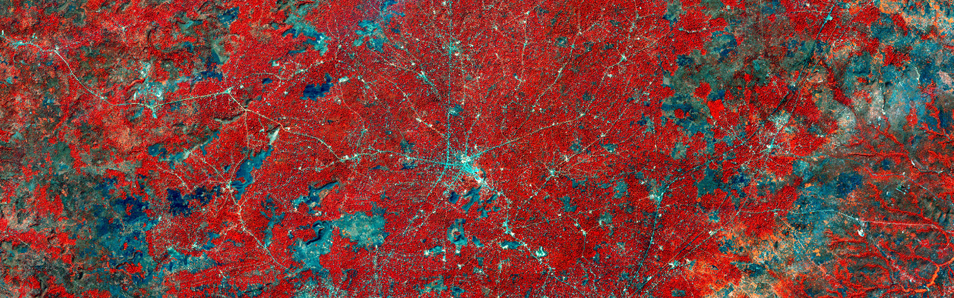
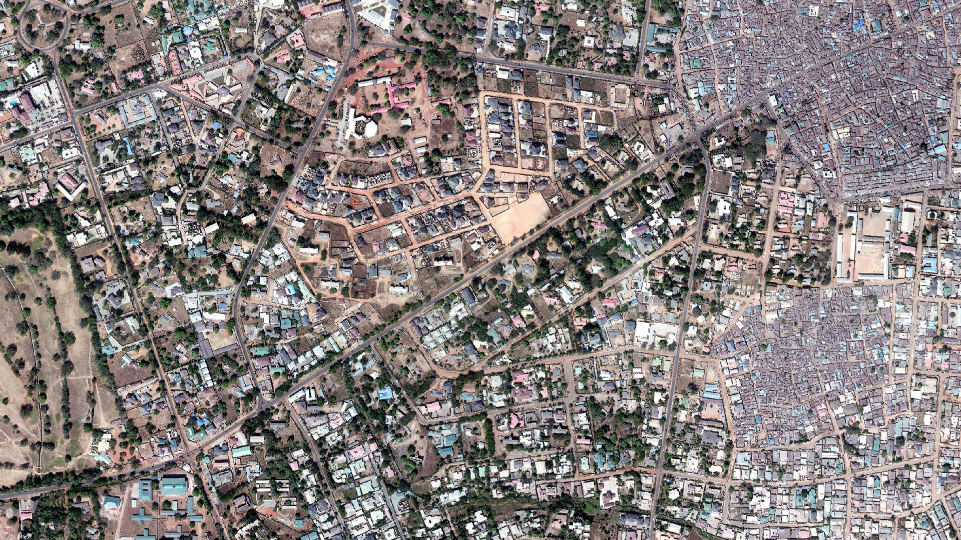
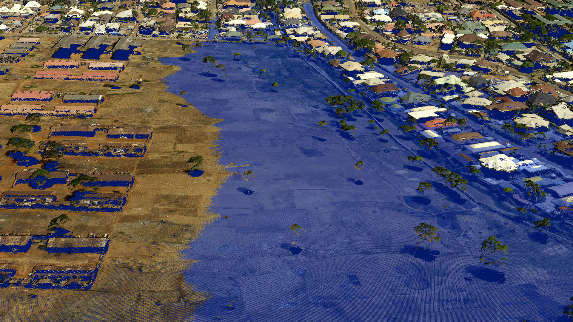
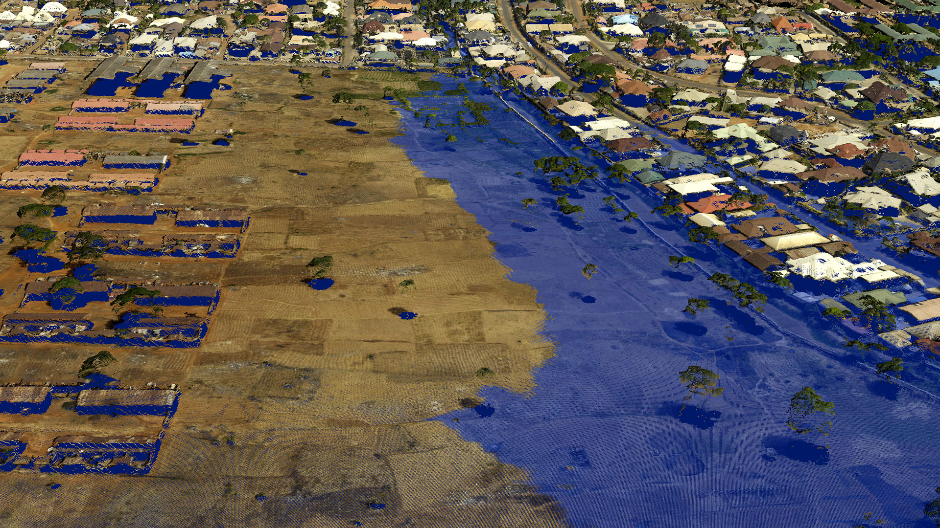
- Change detection (Urban, environmental, work progress monitoring)
- Detecting and mapping deforestation
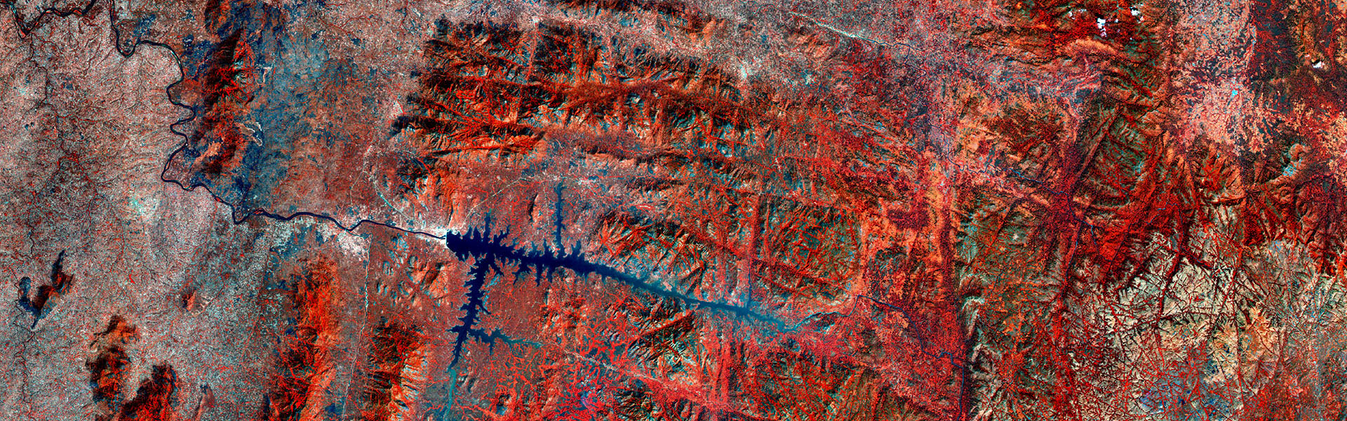
- Erosion control and landslides monitoring
- Tectonic activity
- Monitoring Soil moisture and crop analysis
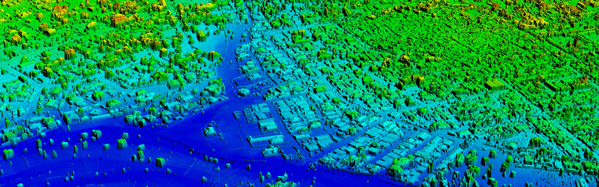
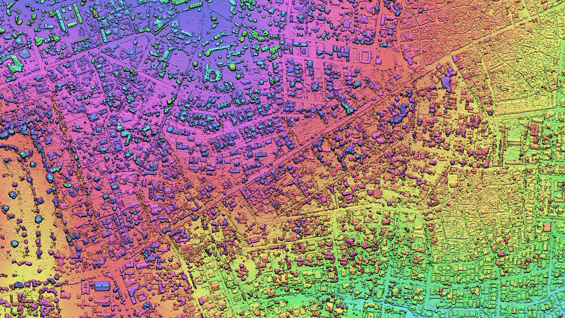
Digital Elevation Extraction From Stereo-Satellite Imagery
Lebanon Office
Beirut P.C. 2601 0506 Karantina Bridge Azar Building, 6th Floor
+961 1 259 446
+961 1 259 447
info@gistransport.com
Nigeria Office
Abuja Nigeria Plot 1042 Kur Muhammed Avenue Ekiti House – Central Business District
+234 803 315 4424
info@gistransport.com
Iraq Office
Baghdad Iraq Q929-R17-H5 Babylon District Arasat Al Hindiya
+964 771 3456 358
info@gistransport.com
Uganda Office
Frist Floor,Century Building , ParliamentAvenue/MLHUD Kampala , Uganda
+256 (0)793599999
info@gistransport.com